Thank You For Making the 2014 ASPRS UAS Symposium a Huge Success!
 Reno buzzed with excitement on October 21-22 during the ASPRS UAS Symposium. Over 500 attendees from the UAS, geospatial, government, academia, and media industries participated in the inaugural event, demonstrating the strong demand for UAS mapping applications. Sessions were filled to capacity due to the impressive lineup of speakers, and the over 70 companies who participated helped pack the exhibit hall with excitement. The live demonstration showcased the wide-ranging diversity of UAS as attendees experienced the pleasure of watching flights in action at the ASPRS calibrated test course. An sUAS workshop, led by GeoCue Group, capped off the momentous event.
The Symposium Planning Committee and ASPRS thanks all of those who attended and contributed in making UAS MAPPING 2014 RENO an overwhelming success!
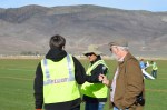
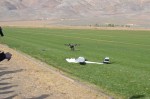
Photos from the Symposium
View the galleries from Reno below! If you have photos from the symposium, please share them to our Facebook page, or email them to the webmaster.
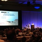
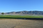
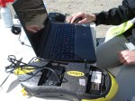
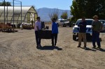
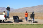
RENO BALLROOM


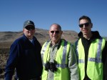
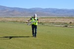
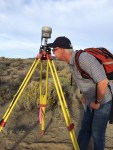
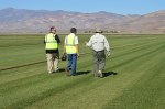
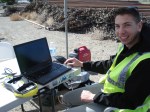
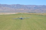
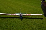
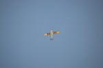
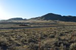
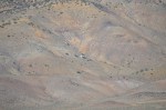
HOBBY FLIGHTS


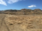


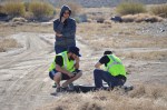
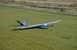


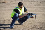
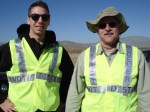


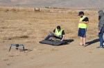


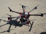


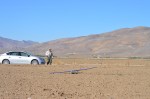


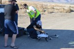


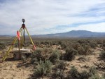


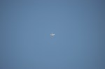


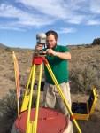


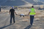
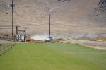


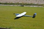


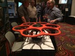
LIVE DEMONSTRATION


UAS MAPPING 2014 RENO in the Media
A number of media outlets have reported about there experience at the UAS symposium. Check out the links below to read their insights:
Brittany Mabry, ASPRS Heartland Region: ASPRS UAS Symposium and Technical Demonstration a Resounding Success
Susan Smith, GIS Cafe: Special Coverage: UAS: Disruption in the Skies
Colin Snow, Drone Analyst: GIS: The Biggest Little Drone Market in the World
Questions and Answers from Symposium Speakers
For Stewart Baillie, Unmanned Systems Canada
QUESTION:“How did Canada’s regulation of UAS balance the conflicting needs of privacy considerations, security concerns, environmental impacts (noise), with the industrial & commercial efficacy opportunities for UAS? Please send a link to Canada’s regulations.”
ANSWER: “My answer: The regulations in Canada are similar to many other jurisdictions, and the responsibilities for various aspects are spread amongst a number of government departments and sets of regulation. As an example:
The various parts and systems of an airliner that are in use by a flight attendant are typically mandated by Transport Canada rules. Similarly, the maximum length of duty day is defined by Transport Canada based on safety considerations. The above being said, the general workplace for a flight attendant is governed by Labor Laws developed by another government department, as are hiring and firing regulations. Similarly, anything to do with the transport of dangerous goods has a Transport Canada aspect, but also aspects governed by Environment Canada and other parts of the Canadian government. Finally, the Canadian Criminal Code applies to flight attendants and passengers, whether they are flying or walking to and from work.
This is a long winded way to get around to talking about the various concerns identified in the question. The various issues raised in the question are governed in Canada by regulation from a variety of government departments:
Transport Canada regulations concern aspects of the aircraft system, pilot and crew and operations that directly concern the safety of people and property on the ground and other airspace users.
Privacy concerns in Canada are dealt with by the Office of the Privacy Commissioner, who has developed a very good report on UAS and Privacy, (OPC Research Reports: Drones in Canada: Will the proliferation of drones in Canada raise new concerns for privacy” March 2013) and is responsible for any legislation on this issue (similarly, surveillance from helicopters is not governed by Transport Canada regulation, but rather from OPC and Justice regulation). (It is important to note that in this regard, it is my understanding that privacy has long been dealt with in Canadian Law on a more rigorous basis than in other jurisdictions).
Environmental impact would be dealt with by Environment Canada, but to date no particular issue has been raised in this area (although some discussion of the hazard of battery types has taken place).
Security issues are dealt with by both the Department of National Defense and Department of Justice (and probably others)
Overall this approach has ensured that the experts in transportation issues only deal with those issues that they are expert in – I should also point out that the full spectrum of UAS related issues are entirely settled – the debate over privacy continues, and our whole system of UAS approval is very much in a “let’s slowly roll this out, learn about best practices and areas where problems arise, and then evolve are regulation to be the best possible” mode. I do not believe anyone in Canada believes that the regulations in place right now are the final ones, they are just ones that enable us to learn and develop.”
For Antoine Martin, Pix4D
QUESTION: “Something new I learned is the raycloud concept and computer vision algorithms to create image base[d] point clouds. My question is how can these point clouds be georeferenced? Obviously GPS is needed and perhaps an IMU. If desired can a single frequency GPS be used or is dual frequency L1/L2 survey grade required?”
ANSWER: The point cloud can be georeferenced (have the correct position, scale and orientation) by assigning GPS location to the images or by using Ground Control Points (GCPs). Pix4Dmapper does not require IMU data.
Normally the image geolocation (coordinates of the images) is not very accurate due to low accuracy GPS. In this case we recommend the use of GCPs. Normally, the GCPs are measured with survey grade accuracy and improve significantly the accuracy of the model (from meters to centimeters).
If GCPs are not available, then the accuracy of the images coordinates will affect the accuracy of the model. So, having a dual frequency survey grade GPS for the image geolocation will give very accurate georeference to the model. The good synchronization of the GPS and the camera is an important factor that has to be taken into account.
Useful relative articles:
https://support.pix4d.com/entries/27224797-How-the-onboard-GPS-affects-the-accuracy-of-a-project-
https://support.pix4d.com/entries/27103377
https://support.pix4d.com/entries/27021968-Accuracy-of-Pix4Dmapper-Outputs
For Qassim Abdullah, Woolpert & ASPRS
QUESTION: “How is the proposed ASPRS Positional Accuracy Standard different from the NSSDA standard? If it is similar, derivative, then it should be referenced explicitly.”
ANSWER:
For Jeff Young and Genie Hays, LizardTech
QUESTION: “Does decompressing a compressed image restore it to original resolution?”
ANSWER: “Great question. If lossless, decompression produces the same pixels as the original file. Restoring the compressed image back to the original resolution.”
For Peter Birch, Google Earth Engine
QUESTION: “How can I get a trial subscription of EarthEngine? Thank you.”
ANSWER: “You can sign up for a free evaluation account of Earth Engine by going to http://earthengine.google.org/signup.”
For Dr. Mukund Rao, National Institute if Advanced Studies, India
QUESTION: “I would like to know what UAS policies your committee proposes for security (“protection against ‘lethal payloads”), safety, environmental impacts (noise), and privacy (surveillance) Thanks you”
ANSWER: In my presentation, I have made it clear that policies are regulations are yet to be issued regarding UAS – even as user and market demand is increasing day-by-day. There are concerns – like in any other country, regarding security, safety, liability, privacy etc. The study on UAS Technology, Applications and Policies that we are undertaking will address some of these concerns and bring an open debate and discussions – and propose broad policy guidelines. Ultimately, the Govt. of India will make policies – I draw attention to the recent UAS Public Notification – http://dgca.nic.in/public_notice/PN-UAS.pdf which clearly states that policies and regulations are being prepared.
In my purely personal view, any technology has a dual character – a public-good, which benefits society AND the opposite disruptive side that is against public-good and harms society (I take the example of cars/vehicles – they serve humanity to move from one place to another BUT are also sometimes wrongly used/driven that brings harm to people; similarly, a knife is another example – it can be best used in a kitchen for good-cooking BUT in wrong hands has been used for abuse and killing purposes). I feel that a good regulation to screen the good-use is essential – rather than bracket all UAV users as potential harm to society (in example of car, a regulation of registration/driver license/road rules/environment compliance etc determine who follows the rules and screens the good users BUT those who break those rules can get easily spotted and law can take its due course). I personally feel that what is essential for UAV case is a good understanding of all such issues related to safety, security, liability, insurance, environment etc; broader and wider discussions and ultimately a good regulation regime that will allow all legitimate and “public-good” use easily possible. In my personal view, National Security has to be paramount – especially in this conflict-challenged world; public safety has to be well-protected – UAV flights should not disrupt safety of people and public/private properties; privacy (from imaging/data) is a larger issue and needs to be best dealt legally; environment noise impacts also maybe a larger issue (if we keep aircrafts in mind and what happens to residents near airports). To me, addressing these (and other) issues is the utmost challenge and we are all supporting Indian efforts in this regard. More specifically, to me it was important to learn and know of what other nations are doing – that can be a learning experience which I found in the UAS Reno 2014 Conference.”
QUESTION: “What are the rules for flying UAS in India? Govt [government] vs private?”
ANSWER: As I mentioned in my presentation, the Govt. of India has acknowledged that UAVs have important civilian uses and also that policies and regulations for UAV operations are being prepared (UAS Public Notification – http://dgca.nic.in/public_notice/PN-UAS.pdf).
To me, the regulations and rules should clearly define steps for UAV operations by any category of users and should not make any obvious “discrimination” – for both government and private users the rules and regulations must be similar (is that wishful thinking!!).
Having said the above, in my personal view, I believe that from a aviation perspective, presently UAVs are seen as objects of flight – thus, the general tendency is to apply the CAR Rules of Aircraft (http://dgca.nic.in/rules/car-ind.htm) to them too. But an additional aspect is the UAVs operations (unlikepassenger/cargo movements) – of imaging, data collection etc that are governed by other rules and regulations. According to me, it is these operations that pose additional challenges (also in aircraft imaging/survey etc) of security clearance, approvals etc. yet another aspects is the time-taken and how easy it is to get clearances and approvals – I personally feel that the process must be smooth, easy and time-bound (but it may not always be as one wishes when security, safety etc are involved). I personally hope that these issues would get properly addressed in the regulations and rules that are formulated.”
For Vince Ambrosia, NASA Ames Research Center, and Everett Hinkley, US Forest Service
QUESTION: “Is Forest Service using drones to deliver retardant on a wildfire?”
ANSWER: “No, and no plans to do so at this time. UAS platforms have been envisioned as a system for fire retardant dispersion, given that they are designed specifically for such missions and due to their nature as a safe alternative to manned platforms. Manned fire retardant platform-flying is an inherently risky job and UAS could be developed to take the pilot out of those hazardous situations. Although a Fire Retardant UAS would undoubtedly be valuable, currently there are no immediate planning processes in place to develop / integrate such into a nation system of operations. A Blue Ribbon Panel on Fire Retardant Fleet Status a few years ago, did look into the potential of UAS in these roles. Embry-Riddle Aeronautical University developed CAD/CAM models of a potential UAS platform for retardant delivery to showcase a class project and viability of supplementing the diminishing fleet of qualified retardant aircraft. This is an intriguing concept, as a platform can be specifically designed for a specific mission (rather than a “re-use” of existing technologies (such as a DoD aircraft asset).
Other issues faced with a UAS retardant bomber are how to effectively operate in a dynamic fire situation, where split-second decisions from a pilot are critical to positioning an effective retardant drop. We are sure these issues can be overcome, but still envision the use of UAS as an effective retardant dropping platform to be 10-20 years into the future.”
QUESTION: “Doesn’t this require special skill of a human pilot?”
ANSWER: “Yes, but the issue here has as much to do with the airframe as it does with the pilot (or auto pilot) capabilities and skill.”
For Jeff Sloan, US Geological Survey
QUESTION: “Is the operating training available to the public? Are there materials that one can download on the program? Can you email a link if that exists? Thanks, Nick”
ANSWER: : The Dept. of the Interior has developed training for UAS operations within the Office of Aviation Services that the FAA has approved for Dept. of the Interior UAS operators that is available to the public. The information is distributed through a request to the FAA Integration Office:https://www.faa.gov/uas/
For Shaun Coghlan, Aeryon Labs, Inc.
QUESTION: “What is the distinction between Digital Terrain Model and Digital Surface Model”
ANSWER: “A Digital Surface Model (DSM) is a digital representation of the ground including objects that are in the area being covered. This means it will show the estimated heights of trees, buildings and any valleys in the area. A Digital Terrain Model (DTM) is a subset of a DSM. It is essentially a bare earth model where it will be a digital representation of the area you are covering with objects removes. So a DTM will show you want the ground will look like if there were no objects (ie trees, buildings etc).
Here is a Wikipedia link that has s good explanation of this as well.
http://en.wikipedia.org/wiki/Digital_elevation_model”
For Warren “Bum” Rapp, NAASIC UNR
QUESTION: “Actually, there have been NO COA’s granted since NAASIC was stood up ½ year ago, right?”
ANSWER:
